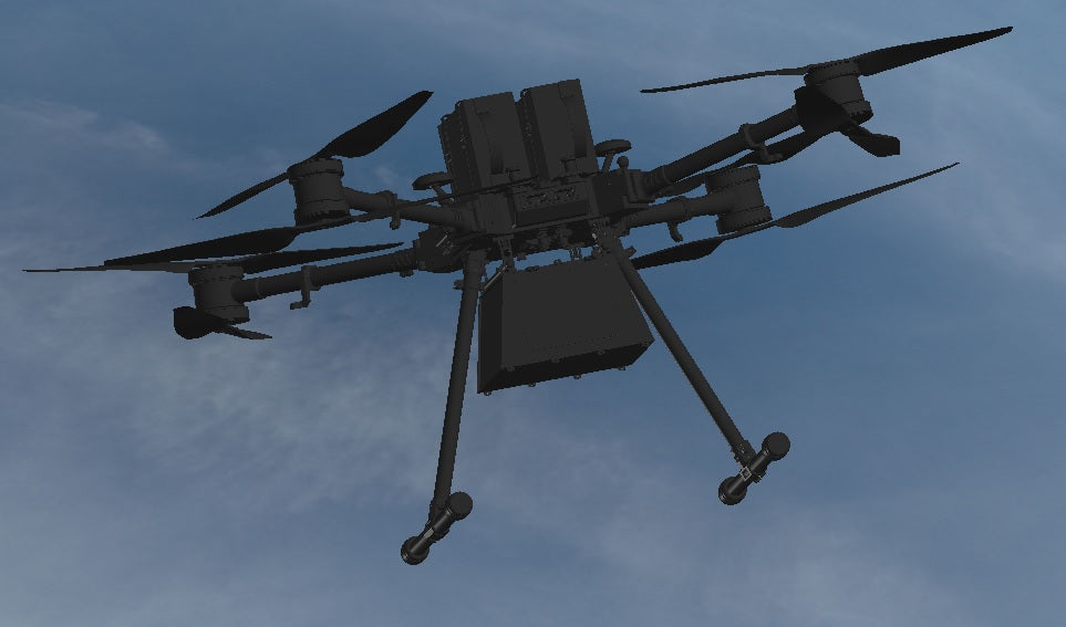
dAAs: dRONES as a service
CamFlite is a reliable and trustworthy provider of comprehensive drone services that cater to all your business needs. Our cutting-edge aerial technology enables fast, precise, and cost-effective data collection that can be customized to fit your unique requirements. As a dedicated partner, we work on-site as an extension of your brand, adding value to your company's offerings.
If you're concerned about the burden of overworking your existing teams, or looking to boost productivity and profitability, CamFlite offers the ideal solution. Our turn-key drone flight services, coupled with efficient data collection and post-processing capabilities, provide seamless end-to-end solutions for your site's data requirements. Partner with CamFlite today, and experience unparalleled levels of efficiency and value for your business.
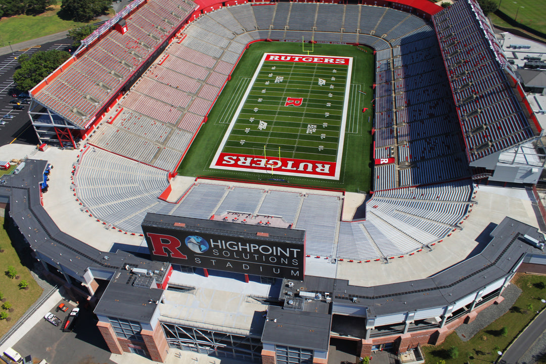
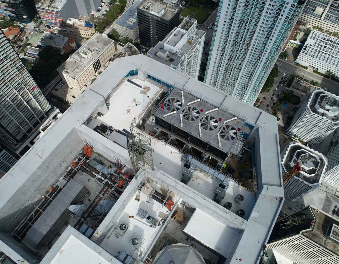
Construction
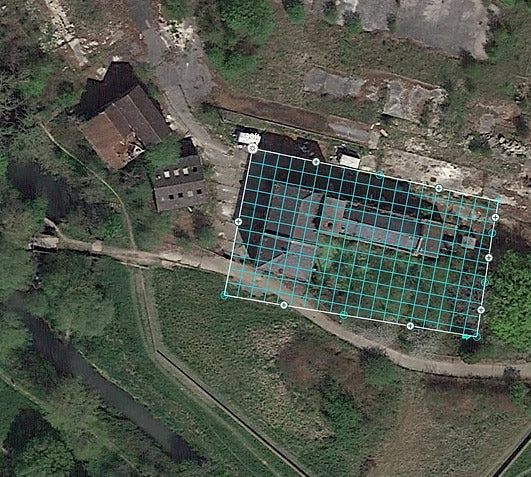
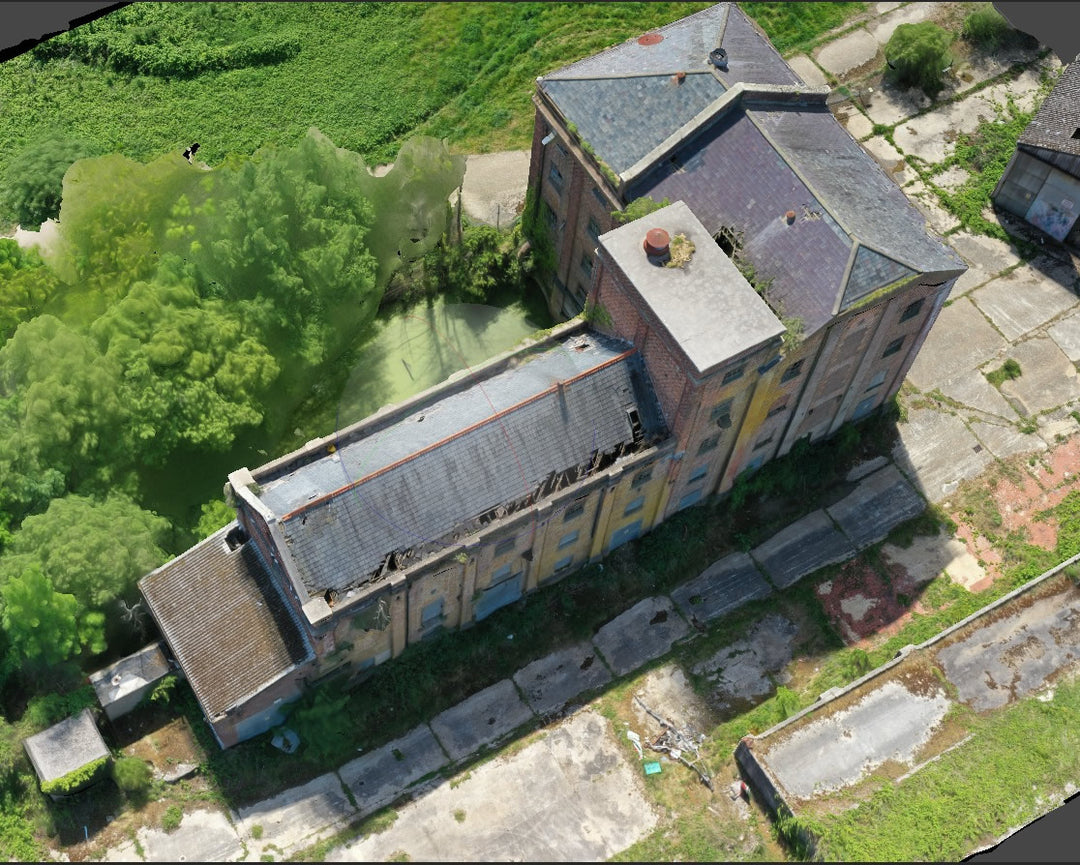
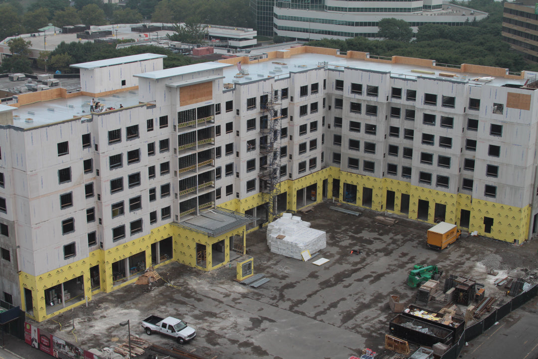
Engineering and construction firms turn to Camflite's sUAS to help digitally track & inspect ongoing projects. Using our software and scanning methods, through either lidar or photogrammetry methods,we deliver results in a highly-accurate digital map of worksites. Camflite sUAS provides the ultimate efficient & documentable approach to ensure the progress and quality of construction projects.
SURVEYING
Camflite's sUAS offer Geospatial experts a reliable platform to carry out aerial surveys with valuable Lidar sensors. We offer redundancies, including a proven fail-safe autonomous parachute system, providing peace of mind when working to survey new property developments, archaeological sites, transportation infrastructure, coastal erosion, and so much more.
SECURITY
At Camflite, we understand the importance of maintaining a secure facility. That's why we offer comprehensive ISR capabilities and secure data transmission to ensure the safety of your premises.
Our advanced EO/IR imaging systems are highly customizable and can be configured with a range of complementary technologies, including power tethers and autonomous charging stations, to create a fully autonomous security solution. This cutting-edge approach enables us to deliver unparalleled security capabilities that are tailored to the unique needs of your facility.
Whether you're looking to enhance the security of a commercial property, government facility, or critical infrastructure, our team of experts is here to provide you with the most reliable and effective security solutions available. Trust Camflite to safeguard your facility and protect your assets with the latest in ISR technology and advanced data transmission methods.
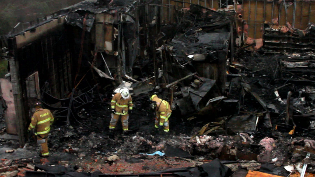
PUBLIC SAFETY
Camflite's sUAS has become the go-to solution for Law Enforcement agencies across various missions, such as emergency response situations, search & rescue operations, and border patrol applications. Our cutting-edge technology provides a reliable and secure data feed, while the high-quality thermal camera ensures the provision of high-resolution imagery that can be deployed in real-time.
Our sUAS technology can function as an effective eye-in-the-sky tool or as a vital component of emergency response efforts, providing critical support in the most demanding scenarios. At Camflite, we are proud to be trusted by Law Enforcement agencies to deliver the highest quality sUAS solutions for the most challenging missions.
Our commitment to innovation and excellence ensures that our products remain at the forefront of sUAS technology, providing our clients with the most advanced capabilities available. Choose Camflite for your next mission and trust us to deliver reliable and effective solutions that meet the demands of your operation.
Payload Delivery
CamFlite sUAS are fully capable for autonomous payload delivery. We offer many solutions to carries a verity of payload sizes. Using AI flight controllers Camflite sUAS are more than capable to get the delivery made!
Drone Services at Site
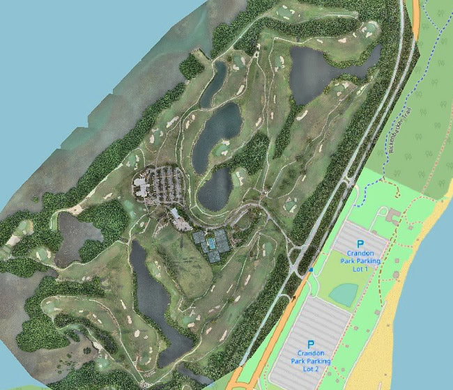
Drones have long been a popular tool for capturing aerial images in the fields of marketing and real estate. However, their full potential extends far beyond these industries. At our company, we specialize in unlocking the complete capabilities of drones through the integration of high-end sensors and cameras with sophisticated data analysis techniques.
Our expertise allows us to transform captured drone images into comprehensive and highly detailed data sets, as well as 3D models and more. With our cutting-edge technology and advanced data processing techniques, we're able to provide unparalleled insights and analysis to businesses across a wide range of industries. Whether you're looking to optimize operations, improve planning processes, or gain deeper insights into your business, our drone services can help you achieve your goals with speed, accuracy, and efficiency.
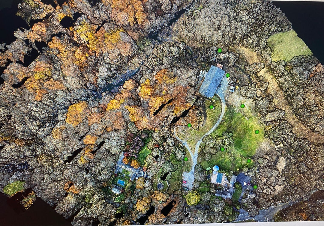
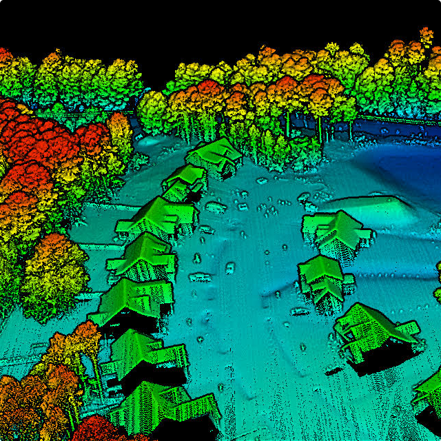
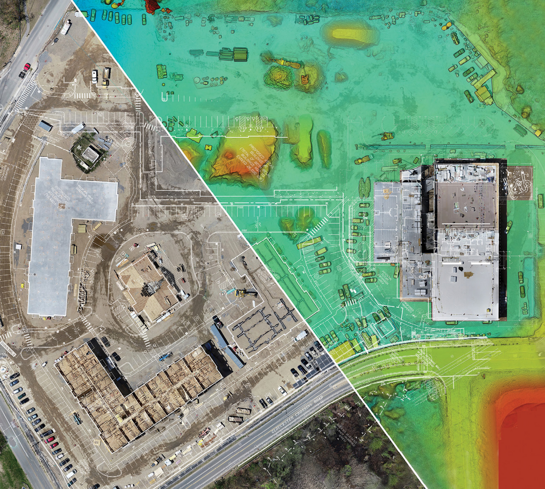
LiDAR
Light Detection and Ranging (LiDAR) is a fast, highly accurate way to examine the surface of the earth by measuring the reflection of light from the surface. Using GPS and inertial measurement. LiDAR measures both distance and elevations to capture data used to create 3D models, topographical maps, and contour maps.
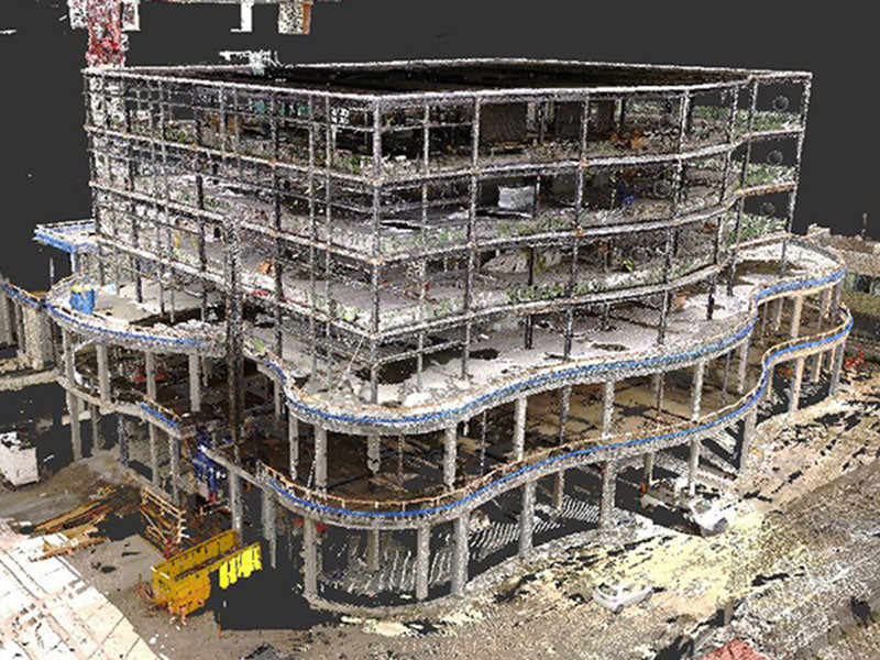
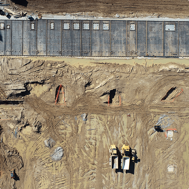
Progress Monitoring
Drones can provide images from a wide variety of angles, including close-up shots and wide-scale aerial images. By following the same flight plan over a period of time, organizations can easily monitor and track progress on your construction project and identify issues before they turn into problems.
Drone Inspections
When assessing sites and equipment to meet regulatory and safety objectives, drone inspections are a key tool to minimize risk and cost while maximizing efficiency. Our drones record data in challenging environments such as the tops of cell towers and inside boilers, allowing inspectors to safely review and make informed decisions.
Drone inspections are used in: Energy companie, Construction, Telecom, Agriculture, Chemical, Utilities, Mining, Recreation and many more!
PHOTOGRAMMERTY
Drone imaging dramatically elevates the benefits of industrial photogrammetry, a method of taking measurements using photographs. Our rapid aerial image capturing and remote sensing capabilities transform high-resolution images into incredibly accurate, thoroughly-detailed 3D renderings of existing structures and landscapes which can be used to aid in projects like mapping and construction planning.